A D R I A N W O O D
Gentrification, Displacement & Environmental Justice
Keynote Lecture for
Atlantic Estuarine Research Society
March 22, 2024

Title slide is a black and white photo of a white man in a 1960s car that is up to its windows in floodwaters. Text superimposed reads "Gentrification, Displacement and Environmental Justice. Adrian Wood, Multimedia Producer, The Repair Lab at the University of Virginia." Photo via NRHA.
Hi, I’m Adrian Wood, my pronouns are they, them and theirs and I am here as the producer of the environmental justice podcast series, Wading Between Two Titans with the Repair Lab at the University of Virginia. The show investigates the intersection of sea-level rise, housing and race in Norfolk, Virginia. Before I share more, I feel it is vital to connect this talk to the reality of the moment we share. Today, a human-made famine looms over 300,000 people in Gaza, who may soon join the over 32,000 dead Palestinians since October 7, including almost 100 journalists and over 100 aid workers. This is genocide.
As we gather today around the theme of environmental justice, in the shared goal of continued life on this planet, we must acknowledge the gravity of this slaughter as we mourn the dead and fight for the living. Beyond the human toll, we witness a deadly surge of emissions. The planet-warming effects of Israel’s aerial bombardment of Palestine in just the first two months of the war were greater than the annual carbon footprint of more than 20 of the world’s most climate-vulnerable nations.
It is critical that we think globally and act locally. That means understanding how environmental injustice is an export of the United States. Almost half of the carbon dioxide emissions from those first two months of war are attributed to American cargo planes flying military supplies to Israel. All researchers involved in developing this measurement have agreed that these estimates are conservative, as they don’t account for methane and other greenhouse gasses.
Here in this Hampton Roads region, dominated by the military, it is critical that we understand the US military’s outsize impact on global greenhouse gas emissions. This impact doesn’t come directly back to us - it is experienced first and worst by people in countries most vulnerable to rising seas and rising temperatures. But it does come back to us in the form of disrupted systems of governance, food instability and resulting increases in extremism from those countries including the Gulf region, which is warming twice as fast as the rest of the world. And here in Hampton Roads, it comes back to us in the tides.
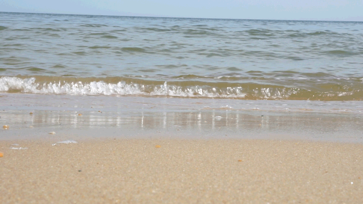
An animated gif shows ocean waves lapping at the shoreline.
War is heating up the planet. This leads to sea-level rise. Hampton Roads has the fastest rate of sea-level rise on the east coast, second only to New Orleans nationally. A 2017 report from the National Oceanic and Atmospheric Administration predicts that Norfolk, Virginia may see up to seven feet of sea level rise between now and 2100. How tall are you? Not that tall. That prediction is based on a moderate estimate. A more extreme estimate would put sea level rise at 11 feet. That's higher than the first story of most buildings. Completely underwater. Today, I will focus on Norfolk, but these stories are coming to a waterfront town near you: Newport News, Hampton, Portsmouth, Suffolk, and beyond.

A historic black and white image shows Church Street in the 1950s or 60s: A restaurant, a cinema and shops line a street bustling with Black families dressed up for an outing. Retro cars line the sidewalks. Image courtesy NRHA.
The first to feel the higher tides are people who live at the lowest elevations. In Norfolk, this includes areas like Church Street. In the late 19th and early 20th century, racist law and culture dictated that Church Street was the only area that Black owned businesses were allowed to be. The swampy, low-lying land was also cheaper for Black purchasers who were dealing with economic inequities. Church Street has seen some of the worst of Norfolk’s historic flooding due to the City of Norfolk failing to invest in public infrastructure in this historically Black area. To this day, it still floods terribly.
Sea-level rise in Norfolk takes some unexpected shapes, too. It’s not quite as simple as people living near sea-level getting flooded out. People living at higher elevations are also at risk – not of flooding, but of displacement due to preemptive measures being taken around the flooding. Here’s what that looks like.

A cropped image of Norfolk on the 1940s redlining map. Berkley is zoned red, along with Chesterfield Heights and St Paul's.
In Norfolk, neighborhoods like Berkley on the Southside are at a higher elevation than the rest of the city. In the early 1940s, Berkley was marked red on the federal Home Owner’s Loan Corporation maps - the suite of real estate guides that are now known as redlining maps. These maps were literal paper maps drafted by local realtors to advise the federal government where to invest in – and where not to. The maps were also internal mental maps for the realtors and banks and public officials in Norfolk, reflecting racist, classist beliefs of the local real estate industry.
Because Berkley was redlined, home values dropped. Redlining essentially guaranteed that the neighborhood would not be invested in by the federal government. Meanwhile, segregation was raging on. In Norfolk and across the country, Black people were unlikely to get approved for federally insured mortgages. There were massive benefits that came along with those loans that only white people could access. These factors combined with regular, everyday interpersonal racism have shaped neighborhoods along racial lines in patterns that still persist. Today, Berkley is a very close knit neighborhood, full of character, very historic – and 98% Black.

A boomerang-style gif shows 3-story wooden houses in Berkley, tinted blue with early evening light.
The legacy of disinvestment in a higher-elevation Black neighborhood like Berkley puts it in a precarious position in the time of sea-level rise and simultaneous gentrification. Berkley’s full of 100-year-old Victorian mansions, a lot of which are now sitting empty and getting run down as younger generations have moved out to find better jobs or live closer to a grocery store. Meanwhile, that sexy waterfront property in downtown Norfolk is now at a much greater risk of flooding due to sea-level rise. So those big beautiful Victorian mansions on higher ground in Berkley are now looking pretty good to wealthy people who want to live on a beach. When it comes to housing and flooding in Norfolk, because of historical redlining and racist housing policies, Black neighborhoods tend to be appraised at lower values. That makes those places more appealing for developers who can renovate homes there and resell them at higher prices to affluent buyers being chased from the waterfront by sea-level rise.
This process is facilitated by city policies that create incentives to move people into the historically disinvested areas. One example of this is Norfolk’s Vision2100. This map divides the city into different zones of resilience, with an emphasis on contributing more resources to areas that are already disproportionately white. It also encourages people to move into previously disinvested areas–which tend to be higher elevation areas, further from the coast, that are disproportionately Black. The people that are already living in those places–Black families – now must find a way to pay for the increasing mortgages while watching the culture and fabric of their neighborhood change. If they can’t afford to stay, they are displaced.
Displacement comes with many risks to health and well-being, including disrupted access to schools, healthcare, healthy food choices, and social networks. Lack of access to those key resources is associated with increased vulnerability and worse health outcomes. Some studies show displacement is correlated with shorter life expectancy. That is an unacceptable level of disproportionate risk for low-income and communities of color to bear as a result of human-caused climate change and human-caused displacement. These risks are part of the danger of sea-level rise in Norfolk and in other cities. It’s not just what the water is doing; it’s how we respond to it. Right now, our response to sea-level rise data is to repeat patterns of harmful and racist displacement in city planning and real estate.
This is not to say there is nothing being done structurally to protect the City of Norfolk from rising sea levels. The City has 3 main structural interventions: The St Paul’s Redevelopment, The Ohio Creek Project, and the Downtown Floodwall. I’ll talk about each of these briefly.

An image shows the Norfolk Vision2100 map adjacent to a map that shows the same city's area by racial demographic.
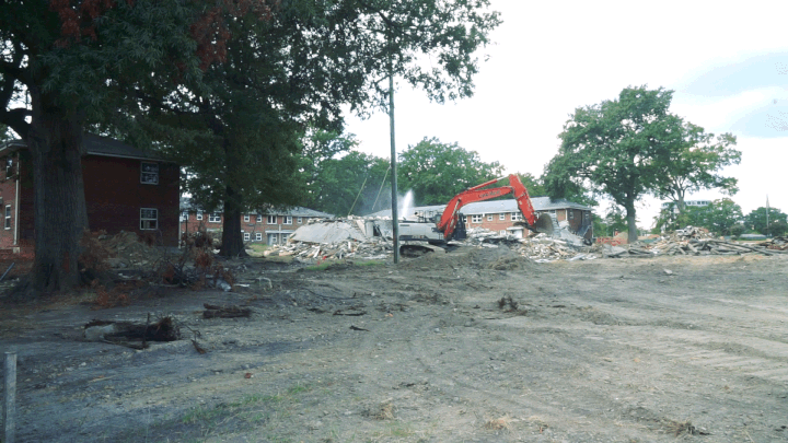
An animated gif of an orange excavator machine in the ruins of what was an apartment building in former Tidewater Gardens.
The St Paul’s Revitalization is a redevelopment initiated in 2020 that offers some of Norfolk’s most intensive flood mitigation to the St Paul’s neighborhood, located adjacent to downtown. This area is known for flooding largely due to being built over top of a filled-in creekbed. St Paul’s is adjacent to historically Black Church Street. The whole area was redlined in the 1940s. Before the redevelopment, St Paul’s was comprised of three public housing complexes. After the redevelopment, 44 acres of what was formerly a public housing complex called Tidewater Gardens will receive a new stormwater system and a blueway that restores that creek that was originally filled in.
About 600 low-income apartment units were demolished to make way for this and about 700 market-rate apartments are being constructed. A small percentage of those units are set aside for former residents. This revitalization will result in the displacement of most of the former residents of the 95% Black Tidewater Gardens – hundreds of people already experiencing economic precarity. These families are casualties of redevelopment fueled by human response to sea-level rise, a slow-moving climate change disaster.
This displacement follows the pattern of urban renewal launched in the early 20th century that forcefully moves low-income and communities of color out of the way to make room for repopulation of those areas with wealthier whiter residents. Norfolk has done this in Ghent, Atlantic City and now St. Paul’s. There are residents of St. Paul’s who are former residents of Ghent and Atlantic City, who are experiencing the psychological trauma of displacement for the second or third time in their own city – now, accelerated by the pressure of rising tides. These residents will be at greater risk of problems with their mental health as well as physical health due to displacement and its effects.
.jpg)
A photo of a construction site with orange cones and weeds growing around it frames 2-story homes in Chesterfield Heights. There are trees and a blue sky in the background.
The second major infrastructure project the City of Norfolk has undertaken to mitigate sea-level rise is the Ohio Creek Project. This project aims to reduce flooding and improve public space in an area called Chesterfield Heights, which is about 90% Black. The overall plan includes a berm, like a big seven foot earthen mound that keeps the water in the river and not in the street, as well as raised roads, a pier, a wetlands park with grills, outdoor learning area, sports field playgrounds, and a natural shoreline. Champions of the project support it as an example of green infrastructure: reducing flooding without using tons and tons of concrete, to support wetland ecosystems as well as human cohabitants. From the outset, a central intention of this project was community participation in planning. But on the ground, things look different.
I heard from community members in this area who did not feel involved at all in decision-making around this project that will have a huge impact on their day-to-day lives. Residents also faced dangerous conditions due to adjacent construction on the project. Meanwhile, as the Chesterfield Heights area gets surrounded by more and more amenities-- the park, the pier, the grills-- the value of the land by square foot will increase. Rents will skyrocket. Because it was historically disinvested in, property values in this area are relatively low compared to the rest of the city. Increasing property values means making this area a future target of investment. That means gentrification becomes very likely. Now that Black people have a claim to desirable waterfront real estate, it is threatened to be torn away by market forces and real estate speculation. This is a real experience of the threat of sea-level rise: city interventions will improve the environmental resilience of a neighborhood, but may make it uninhabitable for people of color for other reasons – like property value and gentrification resulting in displacement.
.jpg)
An architectural rendering of the downtown Norfolk seawall. There are iconic Norfolk skyline buildings next to the water. The seawall is a big concrete strip abutting the water.
Let’s look at one more infrastructure intervention in Norfolk. A $1.8 billion seawall that would protect downtown Norfolk from storm surges is currently in development by the Army Corps of Engineers. The proposed seawall is essentially a six to seven foot tall cement wall that stands between downtown and the water, with a gate that opens and closes. When the gates close, the city is protected from a storm surge that comes from the outside. Storm surges come from the ocean when a lot of water piles up due to wind or storms that are happening at sea. And then all that water blows inland. It's not the same as a lot of rain falling on Norfolk, and it's also not the same as sea level rise. Notably, after community advocacy last year, the city has expanded the project to include infrastructure protections for the Southside – the predominantly Black community I mentioned earlier, where Berkley’s Victorian mansions are located. However, these seawalls are designed only to protect against a storm surge. They do not protect the city against rain flooding. They do not protect the city from sea level rise.
When we look at a threat like sea-level rise, a slow moving, ambient disaster, we have to consider history in our planning for equitable futures. Low-income and people of color are in the crosshairs of climate change disasters including sea-level rise, and not just for the obvious reasons of flooding. People are at risk of displacement through climate-change fueled gentrification. That displacement means conditions known to lead to worse health outcomes, like disrupted access to food, education and healthcare. That displacement can be associated with shorter life expectancy.
Gentrification is not inevitable. There are ways of ensuring that people who live in historically disinvested places get to keep living in those places when the City is finally, after hundreds of years, ready to invest in them. Strategies like community approval boards for new development, land banks and strategic zoning can help keep people in their homes while still building resilience to the rising tides.
Environmental justice means much more than meaningful involvement in decision making. It is an active demand to continue to make it possible for people to breathe, eat, drink and live safely in a world that grows increasingly dangerous due to climate change and its effects: sea-level rise, food insecurity, storms, and armed conflict. As a parting message, I call on you as scientists and researchers to cultivate information to support this goal of environmental justice. It does not go without saying that science and the data it produces are not impartial when it comes to issues of injustice. Scientists have a duty to commit to your studies in a way that is transparent, accurate, available to the public, ongoing and sustainable. Centering these values can support a movement towards a just and equitable future.

Image of the show art for Wading Between Two Titans: A Black mother holding an infant with a child clinging to her skirts. A wave rising in the background and further beyond, the City of Norfolk. The Repair Lab logo is in the upper left corner. The whole image is tinted purple/rose.
Finally, if you are interested in gentrification and sea-level rise, listen to my podcast Wading Between Two Titans anywhere podcasts are found or find it on twotitans.org. Thank you.